We specialize in drafting customized figures tailored to the specific needs of your environmental projects. Our detailed and clear illustrations help convey your data in a format that’s both accessible and professional. Whether your project involves site assessments, remediation work, or regulatory reporting, we provide accurate visuals to support your goals.
Examples of figures we produce include, but are not limited to, the following:
Site plans that illustrate project layout and key features
Contaminant distribution maps for soil, groundwater, and surface water
Plume maps that show the extent and direction of contaminant migration
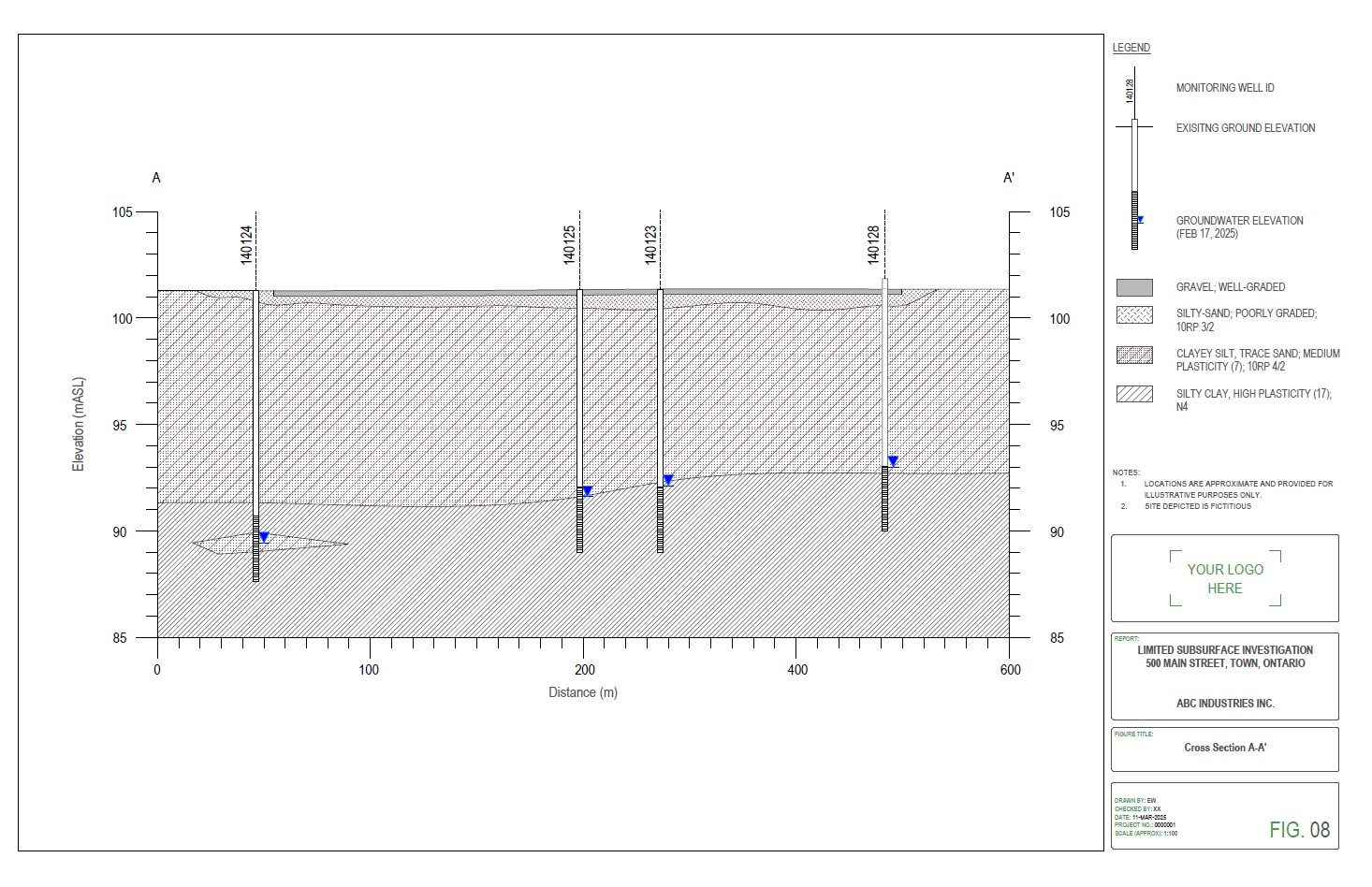
Geological cross-sections to visualize subsurface conditions and stratigraphy
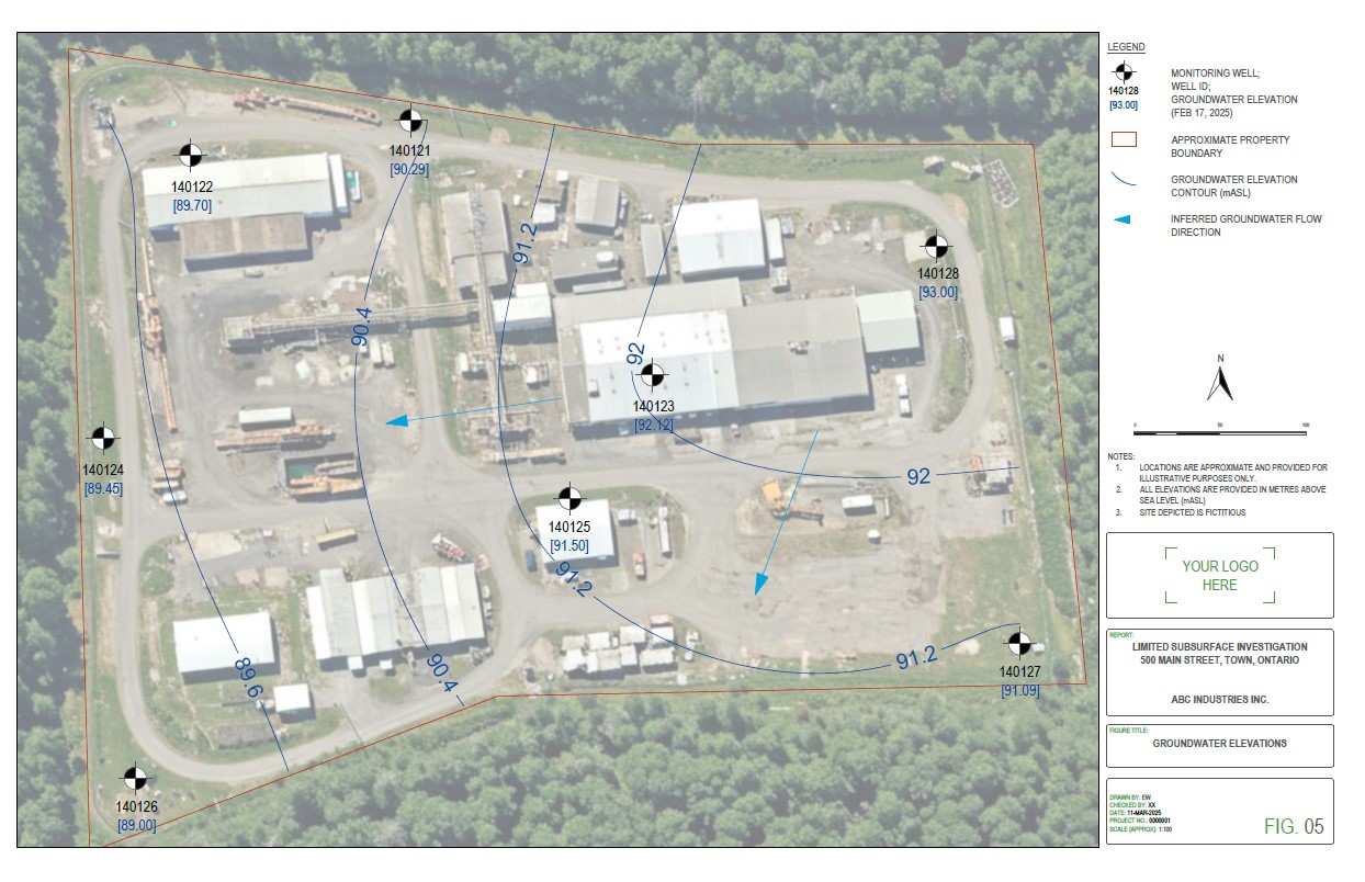
Groundwater elevation contour maps to illustrate flow direction and gradients
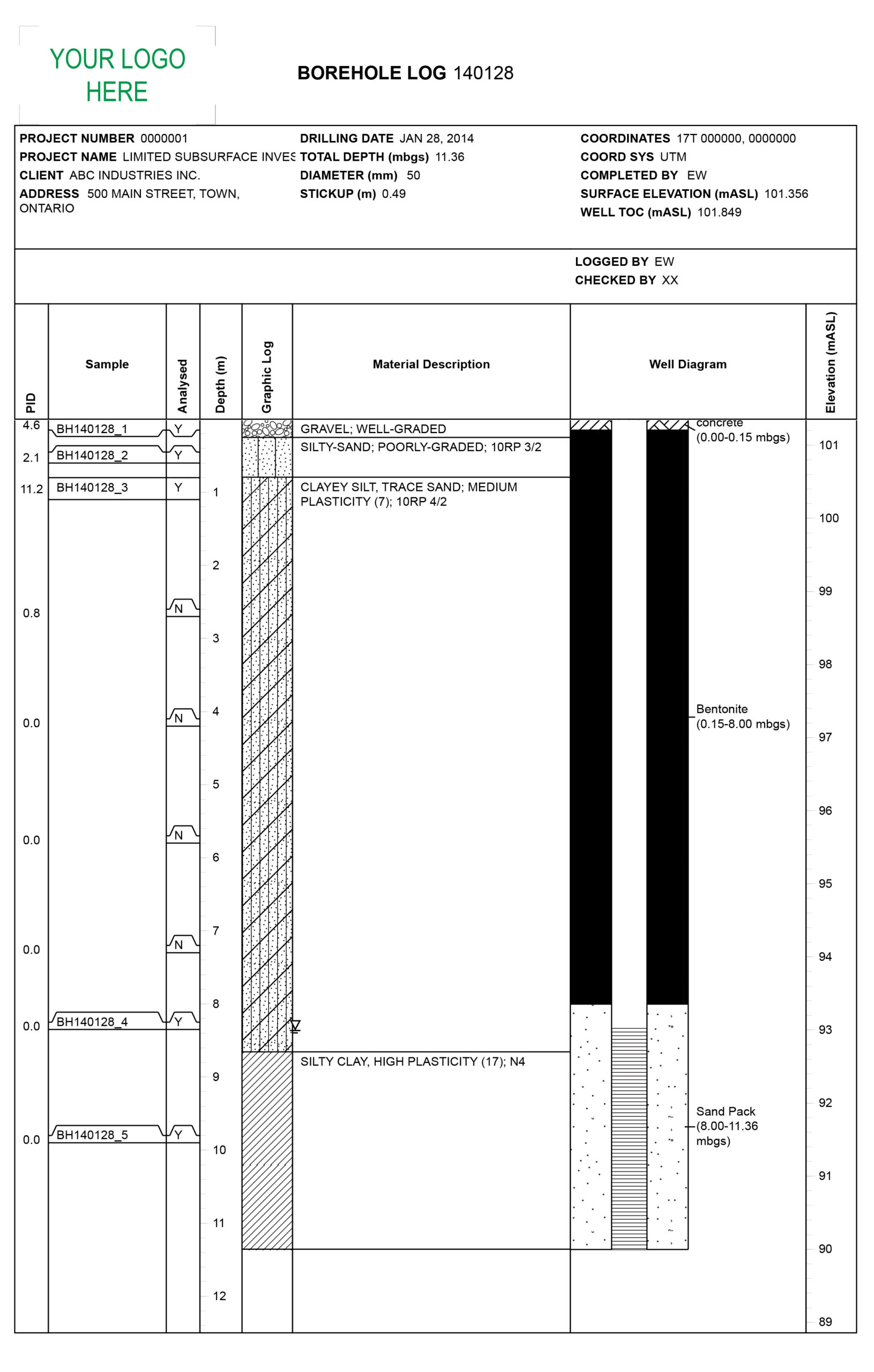
Borehole logs that document soil and rock layers, sampling results, and installation details
See select sample figures below:
Geological Cross Section Sample
Groundwater Contour Map Sample
Borehole Log Sample
Record of Site Condition Submissions
We produce figure packages for Phase One and Phase Two Environmental Site Assessments (ESAs) that support Record of Site Condition (RSC) submissions with the Ontario Ministry of the Environment, Conservation and Parks (MECP).
Our figures provide a clear visual representation of your environmental data, and help you reduce delaysin the review process, requests for clarification or resubmission, or rejection of your RSC filing.
Connect with us today to discuss your RSC filing, and receive a proposal.